About Us
We turn Locations into Opportunities
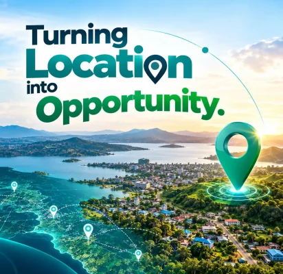
Turning Location into Opportunity
HEYIKO Spatial Technologies Limited is a Tanzania-based geospatial and digital technology company committed to transforming how people understand places, access information, discover opportunities, and solve everyday challenges through the power of location-based technology.
Our approach combines Geographic Information Systems (GIS), digital mapping, spatial data, remote sensing, and innovative digital platforms to connect people, businesses, land, services, and communities.
We believe that location is more than a point on a map. It is a source of information, an opportunity for investment, a connection between people, and a foundation for better decision-making.
Through our professional geospatial services and the development of the HEYIKO digital ecosystem, we aim to make location-based information more accessible, useful, and actionable for individuals, businesses, institutions, and communities.
HEYIKO: Wapi huko?
Know your location. Discover your opportunities.
Who we are
HEYIKO Spatial Technologies Limited is an emerging technology company focused on the practical application of geospatial intelligence and digital innovation to address real-world challenges in Tanzania and beyond.
We bring together mapping expertise, spatial information management, digital platforms, and location-based services to create solutions that support economic participation, community development, business visibility, and informed land-use decisions.
Our work is built around a simple idea: when people have access to reliable information about their surroundings, they can make better decisions and discover opportunities that might otherwise remain hidden.
We are developing an integrated digital ecosystem that enables people to explore places, measure land, discover local businesses, access spatial information, and participate in improving their communities.
From professional mapping and GIS consultancy to digital platforms designed for everyday use, HEYIKO seeks to bridge the gap between geographic information and the people who need it.
Our Story
HEYIKO was established around the belief that geospatial technology should not be limited to specialists, large institutions, or complex technical projects. Its benefits should also reach ordinary citizens, small businesses, landowners, farmers, local authorities, and communities.
In many communities, important information about land, businesses, public services, infrastructure, and local challenges is scattered, difficult to access, or not effectively connected to the people who need it.
At the same time, many local businesses struggle to reach nearby customers, citizens lack convenient digital channels for communicating location-specific community issues, and organizations need better spatial information to plan and allocate resources.
HEYIKO seeks to address these challenges by bringing together geospatial expertise and practical digital innovation.
Our journey combines professional mapping services with a broader ambition: to build a location-based technology ecosystem that helps people understand their surroundings, connect with services, and unlock economic and social opportunities.
Starting in Tanzania, we aim to develop solutions that respond to local needs while remaining adaptable to other markets across Africa.
Our Mission, Vision, Purpose & Te
OUR VISION
To become a trusted African geospatial technology company that connects people, places, data, and opportunities through innovative location-based solutions.
OUR MISSION
To make geospatial information and digital technology accessible and useful by delivering reliable mapping services, intelligent spatial solutions, and innovative platforms that empower individuals, businesses, institutions, and communities to make informed decisions and achieve sustainable growth.
OUR PURPOSE
Our purpose is to transform location-based information into practical value.
We want to help people understand their environment, businesses reach customers, organizations use spatial data effectively, and communities participate in building safer, cleaner, better-informed, and more connected places.
OUR TEAM
We believe that meaningful innovation begins with people. Our team brings together a commitment to geospatial technology, digital innovation, problem-solving, and the development of solutions that respond to real community and business needs.
We are building a multidisciplinary team that combines technical expertise, creativity, local knowledge, and a shared vision of making location-based information more accessible and useful.
From mapping and spatial data analysis to digital platform development and business innovation, we value collaboration, continuous learning, and a customer-focused approach to delivering solutions.
Our Core value
01
Innovation
We explore new technologies and ideas to create practical solutions to everyday problems and emerging opportunities.
02
Integrity and Transparency
We strive to operate honestly, communicate clearly, and handle client information responsibly.
03
Customer Focus
We seek to understand the needs of the people and organizations we serve and develop solutions that deliver meaningful value.
04
Accuracy and Quality
We value reliable data, sound analytical methods, and professional standards in the delivery of geospatial services.
What we do
HEYIKO operates across two complementary areas: professional geospatial services and the development of digital platforms.
1. Geospatial and Mapping Services
We provide and develop professional solutions in:
- GIS and Spatial Data Management: Spatial database development, geographic data processing, spatial analysis, and digital information management.
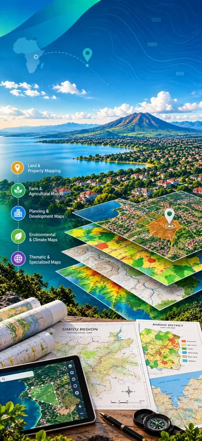
- Digital Mapping and Cartography: Thematic maps, administrative maps, infrastructure maps, land-use maps, and customized map products.
- Remote Sensing and Satellite Imagery: Analysis of satellite imagery, land-cover assessment, environmental monitoring, and spatial change detection.
- Land Measurement and Mapping Support: Land area measurement, plot mapping, and preparation of maps for land-related activities, subject to applicable professional and regulatory requirements.
- Urban and Regional Planning Support: Spatial analysis and mapping to support settlement planning, infrastructure development, and land-use decisions.
- Web GIS and Mobile GIS: Interactive maps, location-based applications, and customized geospatial systems.
- Environmental and Agricultural Mapping: Spatial information and analytical solutions supporting environmental management, agricultural planning, and natural resource assessment.
- Map Printing and Information Products: Professional map printing and the development of customized maps and location-based publications.
Our goal is to turn geographic data into clear, useful information that supports practical decisions.
2. The HEYIKO Digital Ecosystem
We are developing a connected set of digital services designed to make location-based information useful in everyday life.
HEYIKO My Town
A location-based community platform designed to help citizens discover local information, report community issues, and connect with relevant service providers. Potential applications include waste-management reporting, public-service information, and community improvement initiatives.
HEYIKO Measure
A platform designed to help users access land measurement tools, request professional mapping services, and explore location-based measurement solutions.
HEYIKO Business
A digital business discovery platform designed to connect customers with local merchants. Users can discover businesses, explore products and services, compare available options, and identify providers based on their needs and location.
Who we serve
HEYIKO develops solutions for a broad range of users and sectors.
- Individuals and Citizens: Discover places, access local information, and connect with nearby services.
- Businesses and Entrepreneurs: Improve business visibility, connect with potential customers, and participate in the digital economy.
- Landowners and Property Seekers: Access relevant land and property information and connect with appropriate service providers.
- Government and Local Authorities: Access geospatial services and explore digital tools that can support planning, service coordination, and community engagement.
- NGOs and Development Organizations: Use spatial information to support project planning, field activities, monitoring, and evidence-based decisions.
- Agriculture and Environmental Stakeholders: Access mapping and spatial analysis services to support agricultural and environmental initiatives.
- Planners, Researchers, and Professionals: Obtain customized maps, spatial data, analytical support, and geospatial solutions.
We aim to adapt our services to the requirements, scale, and objectives of each client or partner.
Let's Build a More Connected Future
Whether you need professional mapping services, a customized GIS solution, improved digital visibility for your business, or an opportunity to collaborate on a location-based innovation project, HEYIKO welcomes the conversation.
Together, we can turn location into knowledge, knowledge into opportunity, and opportunity into meaningful progress.